Improve with Us

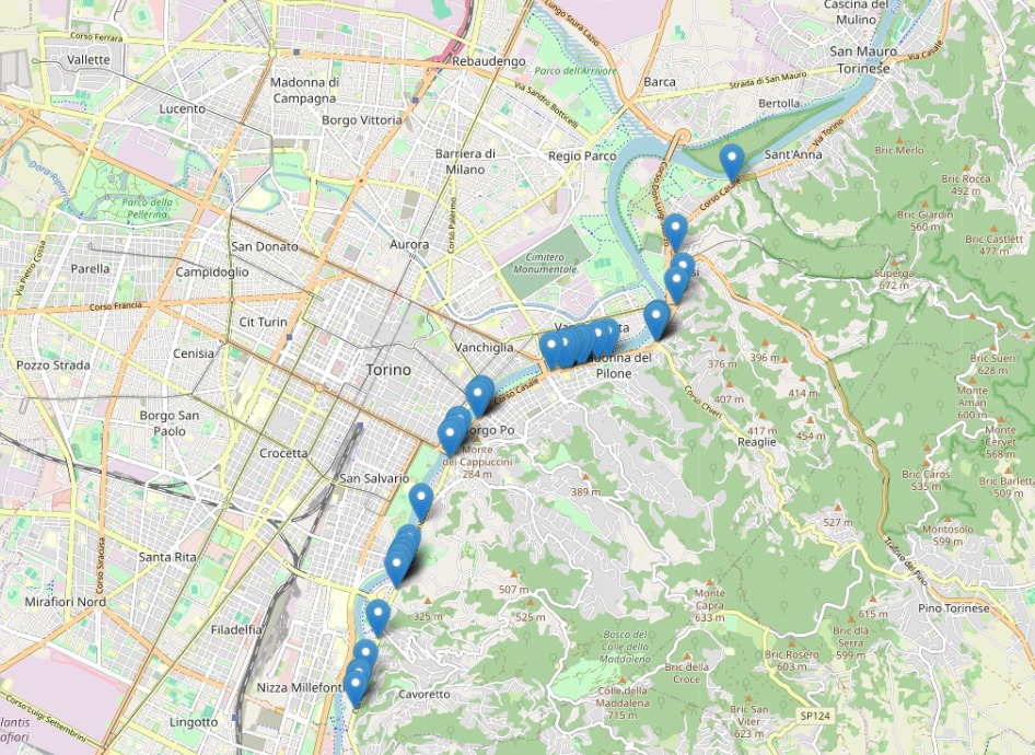
Discover how Asfalto Sicuro® & Aipecra leverage cutting-edge technology to enhance road safety. Our solution identifies and classifies road defects & road elements using AI, IMU, space technologies and GNSS, ensuring safer journeys for everyone.

Discover the Technologies Powering Asfalto Sicuro® and AIPECRA

At LOKI, we harness state-of-the-art technologies to transform infrastructure monitoring and enhance safety. By integrating advanced Artificial Intelligence, high-precision sensors, and satellite data, we deliver solutions that are not only innovative but also scalable and efficient. Our solutions are designed to address real-world challenges with accuracy, speed, and scalability. By combining these advanced technologies, we aim to improve infrastructure safety, optimize resource use, and contribute to a more sustainable and connected urban future. Here’s a closer look at the core technologies driving our success:
Artificial Intelligence (AI) Integration
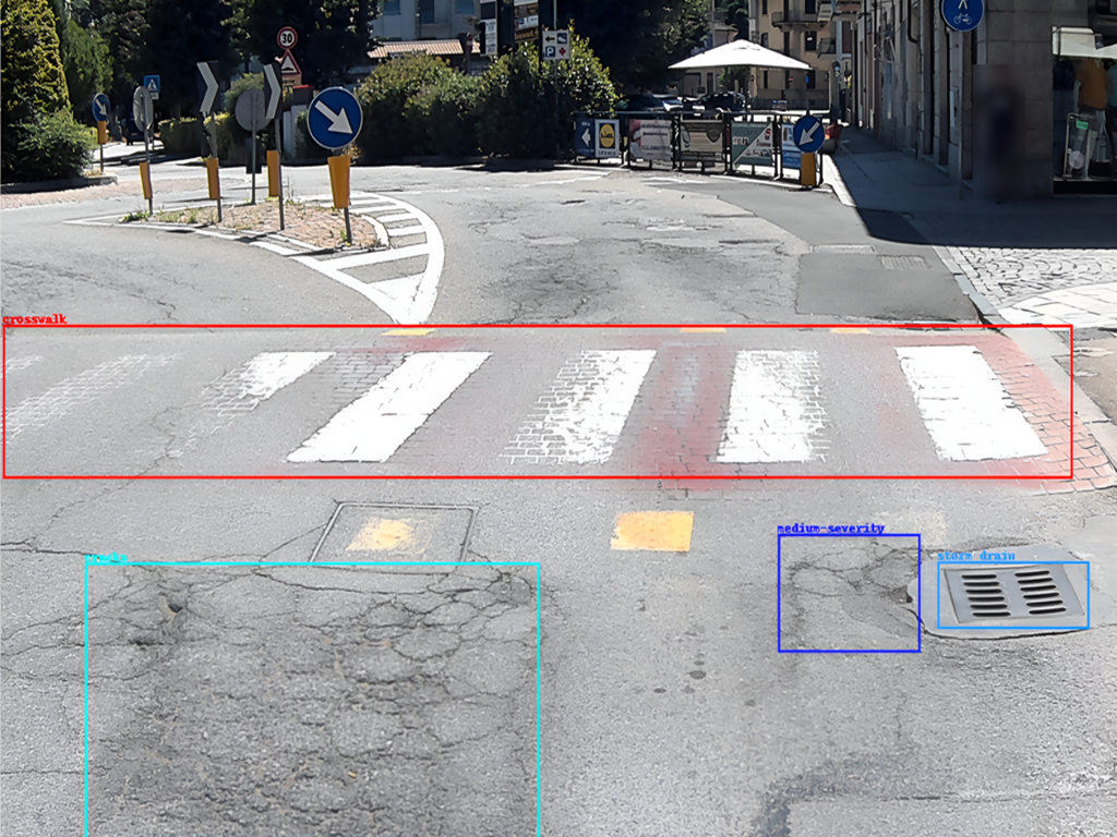
Our advanced AI algorithms are at the core of LOKI’s technology, enabling the real-time processing of extensive data to detect and classify road defects and accessibility barriers with exceptional accuracy. By leveraging cutting-edge machine learning and deep learning techniques, our AI continuously evolves to handle diverse urban and infrastructure challenges, adapting to varying conditions and requirements. Through sophisticated pattern recognition, the system identifies a wide range of road anomalies, such as potholes, cracks, and surface deformations, as well as obstacles to accessibility, like faded crosswalks or missing ramps. These insights are automatically geolocated, ensuring precise mapping and actionable data for decision-makers. A major advantage of our AI is its ability to learn from new data inputs. Each detection refines its accuracy and increases its reliability over time, making the system progressively smarter and more effective. This adaptability allows us to cater to a wide array of environments, from bustling urban centers to rural roadways, ensuring robust performance in any scenario. Moreover, the integration of AI reduces reliance on manual inspections, improving efficiency and safety. By automating defect identification and classification, we empower municipalities and road authorities to prioritize interventions, optimize maintenance schedules, and allocate resources more effectively. This innovative approach not only enhances safety but also supports the creation of smarter, more sustainable infrastructure systems.
Inertial Measurement Unit (IMU)
Incorporating Inertial Measurement Units (IMUs) into our systems adds a crucial layer of precision to road surface monitoring. These advanced sensors detect even the smallest changes in road surfaces, capturing subtle variations that may not be immediately visible. This capability is vital for identifying early-stage defects, such as minor deformations or irregularities, which can escalate into significant safety hazards if left unaddressed. IMUs work seamlessly alongside GNSS data, complementing them. While GNSS ensures pinpoint location tracking, IMUs provide critical insights into surface dynamics, offering robust and reliable monitoring even in challenging environments like tunnels, urban canyons, or areas with weak satellite signals. This dual-layered approach ensures comprehensive coverage and maintains data integrity in diverse scenarios. Additionally, IMUs enhance system adaptability by providing continuous data regardless of external conditions, such as adverse weather or limited visibility. By capturing nuanced changes in surface conditions, these units empower authorities to prioritize maintenance efforts, plan interventions more effectively, and reduce costs associated with reactive repairs. By integrating IMUs, we elevate the precision and reliability of road defect detection, delivering actionable insights that improve safety and sustainability for modern infrastructure systems.
Global Navigation Satellite System (GNSS)
GNSS is fundamental to our systems, providing the precise geolocation data required for effective infrastructure monitoring and management. With decimeter-level accuracy, our system ensures exact mapping and identification of road defects, pedestrian accessibility barriers, and road signage. This high degree of precision enables maintenance teams to target specific problem areas efficiently, minimizing resource waste and reducing intervention times. The ability to detect even small-scale anomalies with such accuracy is crucial for proactive maintenance and safety enhancement. Additionally, our system incorporates advanced data authentication to guarantee the integrity and reliability of geolocation information. By certifying the authenticity of positional and temporal data, it protects against potential threats such as signal tampering or spoofing. This assurance is critical for infrastructure monitoring, where the trustworthiness of data directly impacts decision-making and operational efficiency. The combination of unmatched positional accuracy and secure, authenticated data allows our system to perform reliably in complex environments, whether in densely built urban areas or challenging rural landscapes. These capabilities empower municipalities and road authorities to make informed, data-driven decisions, ensuring safer, smarter, and more sustainable infrastructure management.
Earth Observation Data
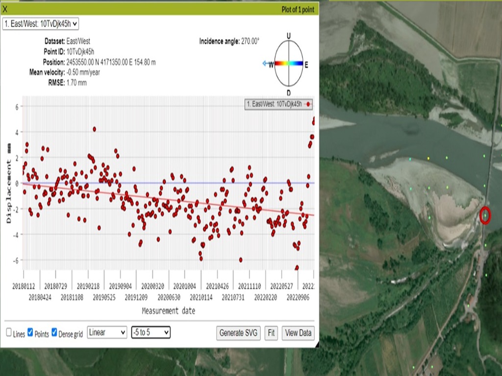
LOKI significantly strengthens its monitoring capabilities by incorporating high-resolution satellite-based data into its systems. This integration provides an additional layer of insights that complement ground-level detection, enabling a more comprehensive understanding of environmental and infrastructure conditions. Satellite data allows for efficient monitoring of large and complex areas, making it possible to detect patterns or risks that might otherwise go unnoticed, such as terrain subsidence, soil instability, or environmental stressors. One of the key advantages of satellite-based data is its ability to offer a macroscopic view of infrastructure health. By observing large-scale changes over time, we can identify early warning signs of potential issues, such as structural stress or vulnerabilities in critical areas. These insights are particularly valuable for prioritizing interventions in regions prone to natural hazards like flooding, landslides, or erosion, where early action can prevent costly damage and enhance public safety. When combined with on-the-ground systems, satellite data creates a dual-layered monitoring approach. This ensures that both the fine details, such as road surface defects, and the broader environmental context are accounted for, leading to more informed decision-making. By leveraging this synergy, LOKI empowers municipalities and infrastructure managers to proactively address challenges, optimize resources, and build smarter, more resilient urban environments.
Cloud-Based Data Processing and Visualization
Our cloud infrastructure is a cornerstone of LOKI’s innovative solutions, providing a robust platform for efficient data storage, processing, and sharing. Designed to handle the high volumes of data generated by our AI-driven monitoring systems, the cloud ensures that all information is securely stored and readily accessible to stakeholders in real time. The system processes incoming data from multiple sources, including high-resolution cameras, GNSS signals, and AI algorithms, transforming raw inputs into actionable insights. Advanced computational capabilities allow for rapid analysis, classification, and visualization of road defects, accessibility barriers, and signage inventories, ensuring stakeholders have the information they need without delay. One of the standout features of our cloud platform is its user-friendly interfaces, which are designed with simplicity and functionality in mind. Interactive dashboards provide intuitive tools for exploring data, such as filtering road conditions by defect type or severity, visualizing geolocated anomalies on detailed maps, and generating comprehensive reports. These tools enable stakeholders—whether municipalities, road authorities, or private companies—to easily navigate complex datasets and extract meaningful insights. The cloud platform also facilitates maintenance scheduling, allowing users to prioritize interventions based on real-time data. This capability not only improves efficiency but also ensures timely responses to critical infrastructure issues, optimizing resources and enhancing public safety. By empowering stakeholders to make informed, data-driven decisions, our cloud infrastructure serves as a critical enabler of smarter, safer, and more sustainable infrastructure management.

LOKI s.r.l. via bertola 12 San Sebastiano da Po 10020 (TO) Italy
© 2024 All rights reserved.
Improving safety through technology.
VAT IT12976210018

AIPECRA is funded by EIT Urban Mobility, an initiative of the European Institute of Innovation and Technology (EIT), a body of the European Union.